Manuel Weakens After Slight Landfall

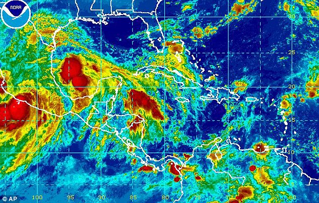
Tropical Storm Manuel weakens slightly after making landfall near Manzanillo, Mexico. The storm, currently dwindling in power, is located 15 miles north of Manzanillo and 160 miles west northwest of Lazaro Cardenas, Mexico.
The storm has reached maximum sustained winds of 45 miles per hour, and is predicted to weaken very quickly into Monday, September 16. It is currently moving northwest at 9 miles per hour and is expected to stay on this path over the next couple of days.
A tropical storm warning issued for the areas between Zihantanejo to Manzanillo is still in effect, as well as the tropical storm watch for the area west of Manzanillo to Cabo Corrientes.
Tropical storm force winds extend 105 miles from the center of the storm, with some of these winds currently occurring in areas within the tropical storm warning area. These same conditions are predicted to reach the watch area by late Sunday, early Monday. Flash floods and mud slides still plague the area, as Michoacan and Guerrero both expect 10-15 inches of rain, with possible 25 inches of rain, and the states of Colima, Jalisco and Nayarit receiving 5-10 inches of rain.
A strong storm surge has been predicted to produce flooding along the coast directly to the south and east of the center of the storm. Large and dangerous waves are expected with the surge. Surf swells caused by Tropical Storm Manuel are effecting the coastal area between the Gulf of Tehuantepec and Manzanillo, and will continue to cause dangerous surf and rip currents over the next 48 hours.
Stay updated on the latest on Tropical Storm Manuel at National Hurricane Center.

Recent Comments